 Data Analytics, Insights & Applications
 Information on ground motion is important for coastal protection and management of underground infrastructure such as water and wastewater pipelines. Until recently, ground motion surveying was a time-consuming process involving acquisition of manual measurements over several years. With the availability of Sentinel-1 radar imagery in 2014, this information can be derived from satellites.
The overall objectives of InSARinSub are to:
InSARinSub visualises digital geological and geotechnical data in 3D-models. It couples these models to derive vertical ground deformation monitoring and mapping by using image stacks from Copernicus Sentinel-1 radar satellites.
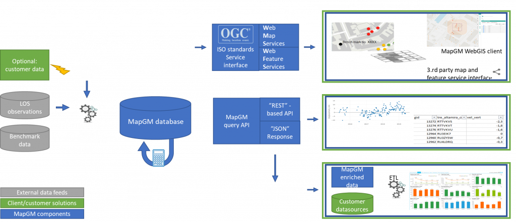
InSARinSub exhibits results and models as web-services or through an API-based data environment. This allows end-users to integrate the products with other data from other sources such as charts of subsurface infrastructure like water and wastewater pipes, climate change scenarios (e.g. sea level rise, groundwater head, precipitation and runoff), and projections of vertical positions of surface and subsurface assets.
Key end-user segments including local utility companies, municipal and national authorities have participated in this activity to ensure that product functionality and operationalisation provides optimal value. For instance, in the utility sector there is a constant push for implementation of measures and technologies, which can assist in achieving more efficient workflows and meet new capacity demands induced by climate change. Ground deformation affects underground infrastructures in different ways and is of significant interest for utility companies. Instances where ground deformation patterns vary over short distances, water and/or gas pipelines may succumb to the stress and break. Other ground deformation patterns may cause a decrease of the pipelines’ slope leading to malfunctioning of the wastewater systems among other issues.
A detailed subsurface model provides answers to how and why the ground-motion occurs and can be used to estimate ground movement even in areas with poor satellite data coverage. To the utility sector, this directly results in a faster and more robust, agile, and cost-efficient renovation of pipelines.
The products developed include:
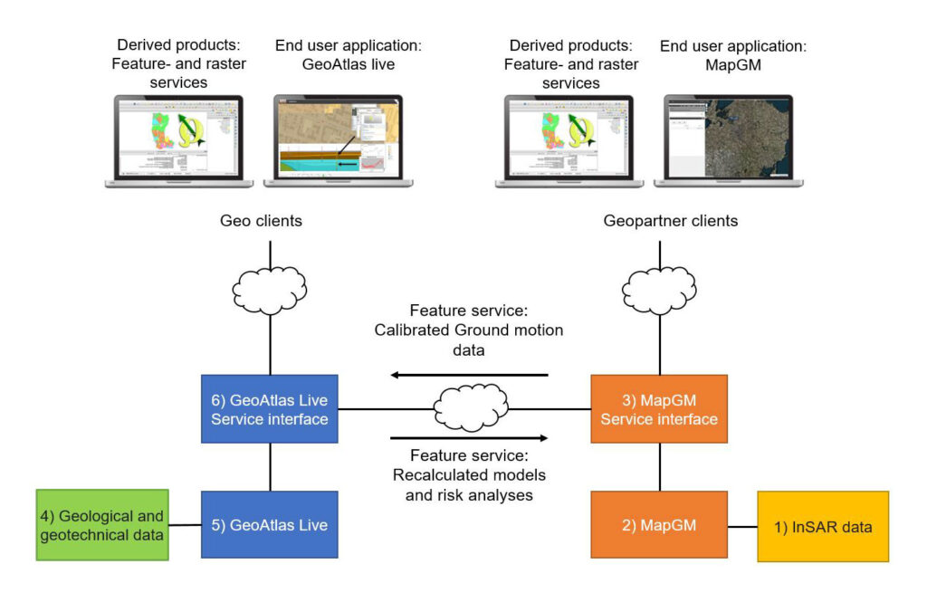
The MapGM and GeoAtlas Live products are made available as Application Programming Interfaces (APIs) through the GeoAtlas Live portal.

The InSAR-based calibrated ground motion products and modelled subsurface/risk analyses are exchanged between the MapGM and GeoAtlas Live platforms.
This synergetic use of ground motion information and geological data is novel. It also strengthens the models and derived risk products as well as return added value ground motion products.
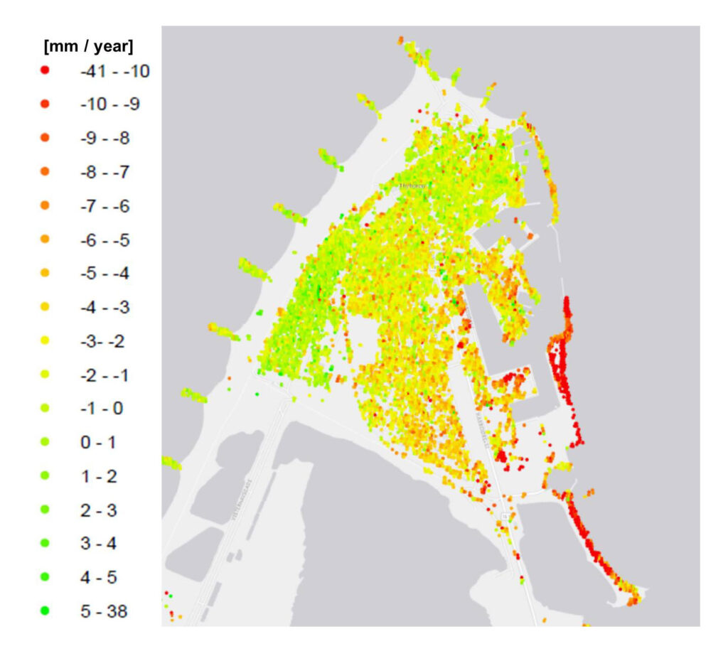
Previously, ground motion maps could not be produced with this level of detail due to sparse or even non-existing data.

Historical benchmarking data for the municipality of Aarhus has been processed and stored in the production database.
An object-based data model has been developed. A key focus point was to generate an efficient data import/export structure in order to secure reliability and performance of the systems.
Routines for import of line-of-sight data into the production database and production of selected value-added products and webservices have been developed.

Geological and geotechnical 3D models have been developed with focus on improving data and modelling methods, model calculations and visualisation in the GeoAtlas Live platform.


The original contract has been achieved according to schedule and the activity was successfully completed and concluded with the final milestone review meeting on January 18, 2022.


