 Data Processing & Visualisation
 High resolution satellite data has enormous potential, but is expensive and not widely available. With limited budget and resources one is often left with data that suffers from haze, distorted colours, and sub-optimal resolution. These problems severely limit the usability of the data.
in1, utilising Artificial Data Enhancement (ADE), provides a solution. Based on state-of-the art software technology, the in1 toolkit can be used to enhance low value satellite data at low costs. Due to the increased resolution, the enhanced data has improved usability and unlocks exciting new use cases for existing datasets and satellite programmes. For example, users will be able to perform more accurate data analyses.
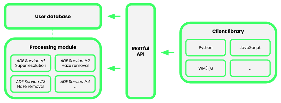
The in1 tools are offered as part of an application programming interface (API) that allows for real-time data enhancement. The API is compatible with different programming languages and will become available as on-premises software in the future, enabling unlimited use.
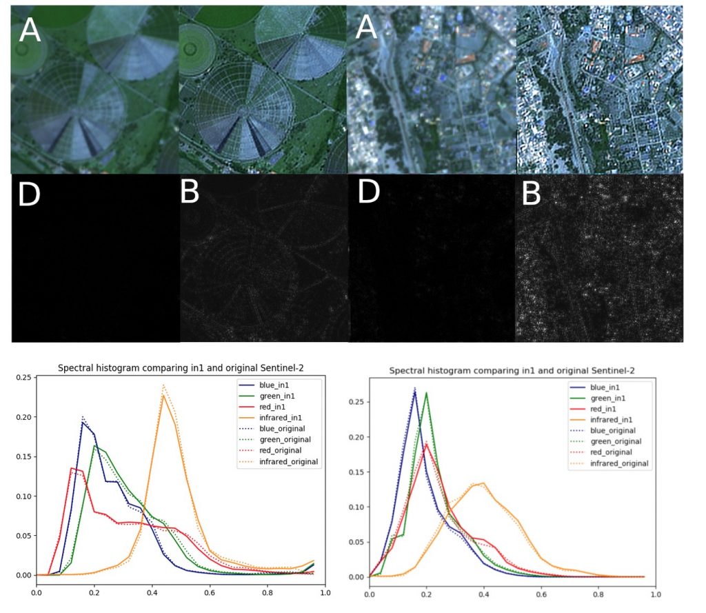
The image below illustrates the enhancement process from low- to high-resolution data using a few lines of coding for the API.

in1 responds to the needs of three types of customers:
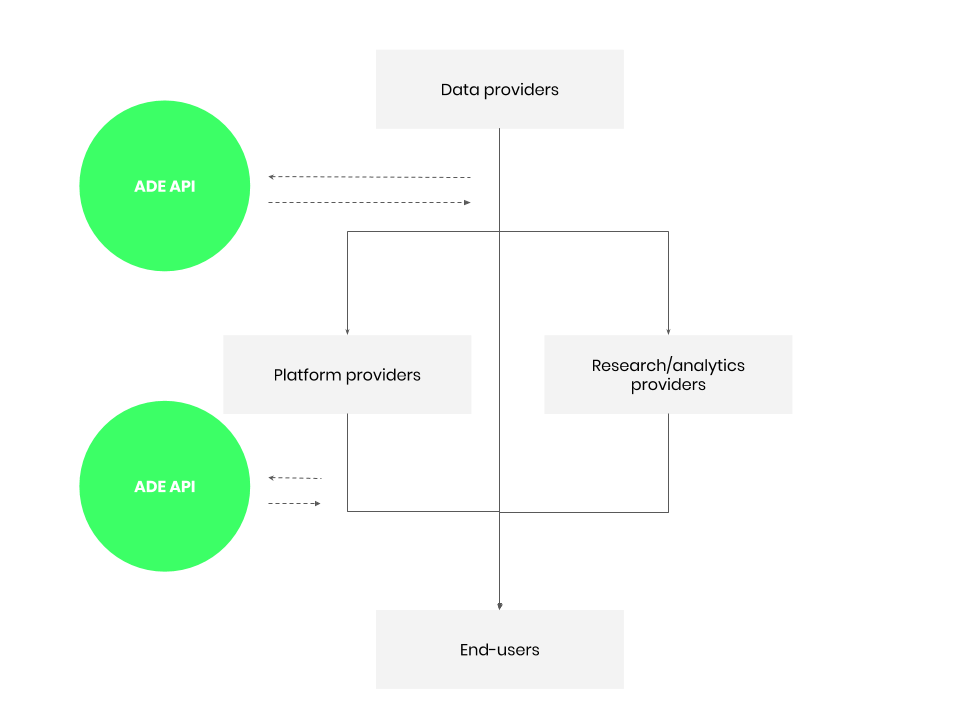
The image below illustrates the product positioning:

The in1 solution targets customers worldwide with a focus on the European Union, Canada and the United States.
in1 provides a solution to problems with satellite data, such as haze, distorted colours, and low resolution. Based on state-of-the art software technology, the in1 toolkit can be used to improve the value of satellite data. The artificially enhanced data is carefully validated, ensuring that it has the characteristics of measurement data and that the physics governing the acquisition process is preserved.
The in1 tools are offered as part of an API that allows for real-time data enhancement. The in1 architecture makes use of the most recent scalable infrastructures that enable on-demand use. The API is compatible with different programming languages and the processing module will also be available as on-premises software in the future, enabling unlimited use.

The benefits of enhanced data quality are:
The ADE activities have been concluded mid-July 2021. Our marketing and outreach efforts gave us unique insights into the EO market dynamics. As a result we have decided to look for partnerships with EO data providers such as satellite operators rather than offering in1 as a service to anyone working with EO data, because the time to market is too long for us. We developed relevant metrics and quality assurance parameters for the AI generated images to give users the confidence that the highly appreciated radiometric accuracy of the Sentinel-2 BRGI are preserved, whilst enhancing the pixel resolution of the original Sentinel-2 images by 4.

