Fondazione Amaldi organises free multispectral and hyperspectral training courses

Join the E. Amaldi Foundation (Fondazione Amaldi), ambassadors of the ESA Business Applications Italy and InCubed Programmes, for a series of free training courses focussing on multispectral and hyperspectral imaging and data. 

The E. Amaldi Foundation was created in 2017 by the Italian Space Agency and the Hypatia Research Consortium to propose a new way of interpreting applied research and technology transfer.

This free series of training courses is aimed at experts, entrepreneurs, researchers and anyone interested in discovering how Earth Observation (EO) satellite data works.

Artificial Intelligence (AI) was the focus of the first virtual training course which took place on 14-15 January 2021. The two day course started with an overview of ESA Business Applications in Italy and the opportunities presented by the InCubed programme. Participants then learnt about the role of AI in multispectral and hyperspectral imaging.

The second free two day training course will focus on the analysis of multispectral and hyperspectral data, taking place on 25-26 February 2021. Participants will learn about basic multispectral and hyperspectral data processing on day one, and advanced processing on day two. During the course, the Italian Ambassadorial Platform (AP-IT) will present the main funding opportunities of ESA’s InCubed programme and Business Applications. Find out more and register here.

Big data analytics applied to multispectral and hyperspectral images will be the focus of the third free training course on 25-26 March 2021. On day one, participants will be introduced to big data and how it is applied to EO. The series will finish on day two with sessions on data mining techniques. Funding opportunities for ESA’s InCubed programme and Business Applications will also be presented. Find out more and register here.


When: 25-26 February and 25-26 March 2021

Where: Online

 To know more, see the full programme and register: Analysis of multispectral and hyperspectral data & Big data analytics applied to multispectral and hyperspectral images
Join the Estonian Industry Day on Thursday 4 February 2021

Would you like your Estonian company to be part of Europe’s Earth Observation (EO) success story? The ESA Φ-lab and InCubed programme will present the opportunities and benefits of EO in this free online workshop on Thursday 4 February 2021. The European Space Agency support for business development and innovation event is organised by Enterprise Estonia Space Office in cooperation with ESA and ESA Business Incubation Centre (BIC) Estonia.

This free virtual workshop will introduce ESA opportunities for Estonian companies such as the InCubed programme and ESA BIC Estonia. The workshop will also explain which activities can be funded and co-funded, what the application processes are, and how the programmes can add value to your business. Business opportunities and challenges facing Estonian companies will also be discussed, and participants will be invited to an open discussion so ESA can better understand your challenges and needs. 

The workshop will focus on two ESA programmes:

More information on the workshop, and how to register for free, can be found here.


When: Thursday 4 February 2021

Where: Online

To know more, see the full programme and register: Click here

EO-PLUGIN becomes first commercial InCubed activity ready for market

GeoVille and partners are the first companies to successfully complete an activity under ESA’s InCubed programme. The Austrian company has developed a new service for the agricultural sector together with partners from Austria (EODC) and the Netherlands (Hermess and Hilbrandslaboratorium B.V).

The agricultural sector is facing major challenges and opportunities, such as climate change, the steadily growing need for food and the implementation of the European “Green Deal Agenda”. Objective and timely information for decision-making is therefore becoming more and more essential.

GeoVille, a company from Austria specialised in the use of Earth Observation (EO) data, has now developed the new EO-PLUGIN service with partners that precisely addresses these aspects. This service is based on optical and radar data from Copernicus’ Sentinel-1 and Sentinel-2 satellites.

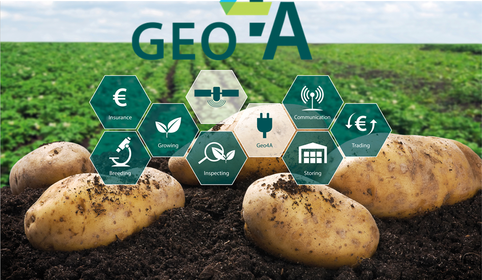
EO-PLUGIN elaborates this information and enables the agro-food industry to integrate it into their work processes in simple steps. The system offers a range of initial customer-oriented services. These include quantification of plant growth, meteorological data and derived statistics, determination of soil moisture, risk assessment for potato diseases, classification of crop types, and yield estimations and forecasting.

GeoVille was co-funded by the Austrian Research Promotion Agency (FFG) and the market-oriented ESA programme InCubed (Investing in Industrial Innovation). ESA provides funds to co-fund market-driven and innovative industry-led activities. InCubed supports companies in the commercialisation of EO focused technologies and services.

The EO PLUG-IN system was first tested by a specially spun out subsidiary called Geo4A, which focuses specifically on services for the agricultural sector. The specialised company was able to build up a strong position in the potato sector within two years.

So far, the activity shows how EO satellite data can be integrated into operational processes to actively support the agro-food value chain. This approach represents a blueprint for the entire EO sector.

The activity was concluded this year following the final review meeting on 1 December 2020.

David Kolitzus, Project Manager of EO PLUG-IN, adds: ‘’The commitment to bring EO based information solutions into the agro-food sector still holds up. The InCubed programme enabled us a quick and innovative market entry through financial and technical support. The primary market is currently the potato sector in the Netherlands. The topics range from reducing losses during breeding and logistics, through control capacities for production and trade, to develop new markets. EO PLUG-IN closes the gap between EO and the agro-food sector and supports public and private actors along the entire global potato value chain.’’


To know more about:

Unibap collaborates with Amazon Web Services

Unibap’s SpaceCloud™ Services framework, co-funded by ESA’s InCubed programme, has become a member of the Amazon Web Services (AWS) Partner Network and will begin integration with AWS. Together, Unibap and AWS will improve satellite data efficiency for aerospace and satellite customers.

On 15 December 2020, Swedish company Unibap announced its membership with the AWS Partner Network and phased integration with AWS during 2021. As well as providing aerospace and satellite customers with real-time access to AWS, this integration will simplify data management with lower latencies and reduced costs.

ESA has been co-funding Unibap’s SpaceCloud™ Services framework since it was selected under the InCubed programme for enhanced software functionality and standardisation in April 2020. Unibap’s collaboration with AWS will allow customers to quickly collect and immediately analyse data instead of relying on traditional storage and processing methods which can take up to 24 hours.

In Unibap’s press release, CEO Dr. Fredrik Bruhn says: “The timing of our collaboration to bring full cloud experience to space is perfect and is the culmination of many years of in-house development and continuous support from the Swedish National Space Agency and the European Space Agency. I am extremely pleased to be taking the next step of cloud computing to space with AWS and foresee enablement of new business models and space mission architectures that benefits commercial and government endeavors”.

Sat4Flood online workshop

In co-operation with the Dutch Network Levee Monitoring, the Dutch company Miramap is organising an online workshop dedicated to the ESA InCubed co-funded activity Sat4Flood.

The workshop will be on Thursday November 26th, from 1:00 to 3:00pm and held entirely in Dutch.

The speakers will explain the functioning of Sat4Flood and show a demo of this product. Two proof of Concept participants, Vlaamse Waterweg (BE) and Arcadis (NL), will also present their first experiences with the application.

To register, please send an e-mail to netwerk@dijkmonitoring.nl


When: 26 November 2020
Where: online


To know more, see the full programme and register: http://www.dijkmonitoring.nl/

Announcement of an InCubed call for Greek companies and possible international partners

ESA InCubed programme just published an open call for Greek companies and partners.

The aim of the Investing in Industrial Innovation (InCubed) programme is to support and develop the Earth Observation (EO) commercial sector. The objective is to de-risk innovative and commercially viable products and services based on EO data.

The focus of Greece within the InCubed is to develop national end-to-end spaceborne capabilities aiming to contribute to a dedicated satellite constellation to provide commercial Earth observation products and services, through international cooperation and focused on addressing national needs

For more information please go to ideas.esa.int, register on the platform and follow the specific Greek InCubed campaign channel.


To know more about:

AARSE Conference 2020

The 13th AARSE International Conference – Earth Observations and Geospatial Science in service of Sustainable Development Goals will be held in Kigali (Rwanda), from 29th March to 2nd April, 2021.

Under the theme “Space and geospatial technologies for the Africa”, this conference will be a major event in the African and international community of Earth Observation and geo-spatial information science in 2020.

The event is organised by the Institut d’Enseignement Supérieur de Ruhengeri (Ines-Ruhengeri) and AARSE. The primary objective of this non-political scientific organisation is to increase the awareness of African governments, the private sector and society at large, about the empowering and enhancing benefits of developing, applying and responsibly utilising the products and services of EO Systems and Geo-information Technology. AARSE members includes professional individuals, institutions and national associations from across Africa and worldwide. These members work in domains related to remote sensing, photogrammetry, and geographical information science.

The AARSE international conference is conducted biennially across Africa, alternately with the AfricaGIS conference, and is the premier forum in the continent for research on remote sensing technologies and geospatial information science, gathering leading scholars from the remote sensing and related communities.


When: 29 March – 2 April 2021
Where: Kigali, Rwanda


To know more about it: https://aarse2020.org/index.php

ESA Space Optics Instrument Design &Technology Course

Optical engineering for space is a highly specialised profession in need of trained and experienced professionals. Technology evolution and market dynamics require the profession to stay up to date with new methodologies for the designing, manufacturing, and commissioning of high performance space optical instruments.

This inspired the European Space Agency (ESA) to organise two types of courses for professionals operating in the space optical engineering sector. The first is dedicated to “Space Optics Instrument Design” and the second to “Space Optics Instrument Technology”. The two courses alternate each year with the 2021 course focussing on Space Optics Instrument Technology.

The course lecturers consist of professionals with long standing experience in the sector. Their accessibility during the course gives participants a unique opportunity to deepen their knowledge with one-to-one meetings as well as planned lectures.

The course also gives plenty of opportunities for participants to develop a professional network. Sharing problems and discussing solutions is the way to develop optical engineers for the space community and space sector as a whole.


When: 09 – 14 May 2021
Where: Poltu Quatu, Italy


To know more about it: https://atpi.eventsair.com/QuickEventWebsitePortal/soidt2020/home

NeurIPS 2020 Workshop – Tackling Climate Change with Machine Learning

The Conference and Workshop on Neural Information Processing Systems (NeurIPS) is one of the premier conferences on machine learning that attracts researchers and practitioners in academia, industry, and other related fields. This year’s event takes place virtually on 11 and 12 December 2020.

It is possible to attend the workshop without either presenting at or attending the main NeurIPS conference. Please register at https://neurips.cc/Register/view-registration


When: 11 – 12 December 2020
Where: online


To know more, see the full programme and register: https://www.climatechange.ai/events/neurips2020#submission-mentorship-program 

MICRORAD 2020

MICRORAD 2020 – Microwave Radiometry And Remote Sensing Of The Environment

Organised by the Italian Centro di Telerilevamento a Microonde and Instituto di Fisica Applicata (IFAC-CNCR), the 16th Specialist Meeting on Microwave Radiometry and Remote Sensing of the Environment (MICRORAD 2020) will be held in Florence from 16-20 November 2020.


When: 16 – 20 November 2020
Where: Florence, Italy


To know more about it: http://www.microrad2020.it/